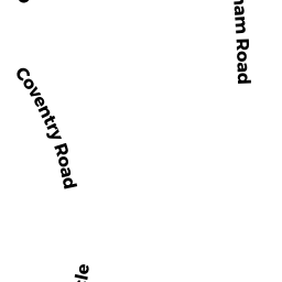
1 COVENTRY ROAD
Owner Information
HESS MARY
1 COVENTRY ROAD
GRAFTON, MA 01519


Property Details
1 COVENTRY ROAD is classified as a Residential Condominium (Townhouse).
The primary structure on this property was built in 1983. There are 2,012ft2 of built area within this property. There is 915ft2 of residential/living space within this property. This property is listed as having 5 rooms.
1 COVENTRY ROAD is valued at $225,100. The land is valued at $0 and the structures are valued at $225,100.
This property is in Zone RMF. Confirm with local Zoning Board authorities to ensure there are no overlays or other easements on this property.
The most recent deed for 1 COVENTRY ROAD is recorded at the local registrar in Book 48546, Page 182. 1 COVENTRY ROAD was last sold on Thursday, February 16, 2012 for $146,000.
Assessment data from fiscal year 2021.
Flood Data
According to the FEMA National Flood Hazard Layer, this property does not appear to be in a flood zone. It may also be in an area not yet reviewed. Nonetheless, confirm this information prior to taking any action.
To view the flood hazards around this property, create a FEMA "Firmette" Map of the area around 1 COVENTRY ROAD.
Broadband Internet Providers
| Provider | Type | Bandwidth (mbps) | |
|---|---|---|---|
| Verizon New England Inc. | DSL | 10 | 1 |
| GCI Communication Corp. | Satellite | 0 | 0 |
| Viasat Inc | Satellite | 100 | 3 |
| HughesNet | Satellite | 25 | 3 |
| VSAT Systems, LLC. | Satellite | 2 | 1 |
Broadband service provider data from December 2020.
Adjacent Properties
- 20 NOTTINGHAM ROAD
Residential Condominium owned by ANNAIYANAIDU ARUN - 38 NOTTINGHAM ROAD
Residential Condominium owned by ALLAINE LOUISE T - 34 NOTTINGHAM ROAD
Residential Condominium owned by O'DAY JOAN F - 19 NOTTINGHAM ROAD
Residential Condominium owned by BISHOP, ANDREW - 46 NOTTINGHAM ROAD
Residential Condominium owned by GONZALEZ, SERGIO - 18 NOTTINGHAM ROAD
Residential Condominium owned by SHRAYER JENNIFER M - 77 LONDONDERRY ROAD
Residential Condominium owned by KALWANI MAHESHKUMAR - 17 NOTTINGHAM ROAD
Residential Condominium owned by MCELROY JOHN M SR - 40 NOTTINGHAM ROAD
Residential Condominium owned by BRAMHALL FRANCES B LIFE ESTATE - 68 NOTTINGHAM ROAD
Residential Condominium owned by DONO JASON H - 64 NOTTINGHAM ROAD
Residential Condominium owned by PROCKETTE, AILI S - 67 NOTTINGHAM ROAD
Residential Condominium owned by ROBBINS, JENNIFER - 30 NOTTINGHAM ROAD
Residential Condominium owned by NUNEZ CAROLINA M - 71 LONDONDERRY ROAD
Residential Condominium owned by ANDERSON, NANCY - 6 NOTTINGHAM ROAD
Residential Condominium owned by LAFLAMME BARBARA J - 24 NOTTINGHAM ROAD
Residential Condominium owned by UYAN OZGUN - 59 NOTTINGHAM ROAD
Residential Condominium owned by BOENNING, KURT - 51 NOTTINGHAM ROAD
Residential Condominium owned by NOCK PHILIP R - 60 NOTTINGHAM ROAD
Residential Condominium owned by THE KAREN M DURAND TRUST - 59 LONDONDERRY ROAD
Residential Condominium owned by SHRESTHA PARAKRAM - 14 NOTTINGHAM ROAD
Residential Condominium owned by MILOT , GEORGIA A - 70 LONDONDERRY ROAD
Residential Condominium owned by MCCORMICK MARY MICHAELA KING - 25 NOTTINGHAM ROAD
Residential Condominium owned by LEACH, KATHRYN T - 63 NOTTINGHAM ROAD
Residential Condominium owned by GEORGE, DEBRA - 52 NOTTINGHAM ROAD
Residential Condominium owned by SPECTOR, DANIELLE A - 1 NOTTINGHAM ROAD
Residential Condominium owned by SHAFFER GRIGGS SENA LEE - 90 LONDONDERRY ROAD
Residential Condominium owned by LAMBERT MARGARET L - 61 LONDONDERRY ROAD
Residential Condominium owned by GOLDSTEIN MARK - 54 NOTTINGHAM ROAD
Residential Condominium owned by WANG, YIXUAN - 26 NOTTINGHAM ROAD
Residential Condominium owned by SUN BIN - 5 NOTTINGHAM ROAD
Residential Condominium owned by LAKEVIEW LOAN SERVICING LLC - 15 NOTTINGHAM ROAD
Residential Condominium owned by QU, YUANTING - 55 NOTTINGHAM ROAD
Residential Condominium owned by 55 NOTTINGHAM LLC - 36 NOTTINGHAM ROAD
Residential Condominium owned by SELIM MOHAMED - 57 NOTTINGHAM ROAD
Residential Condominium owned by BIELEJEC EDWARD J - 23 NOTTINGHAM ROAD
Residential Condominium owned by PADGETT KERRI L - 27 NOTTINGHAM ROAD
Residential Condominium owned by DROHAN KATHLEEN M - 22 NOTTINGHAM ROAD
Residential Condominium owned by DIMAMBRO GAETANO - 11 NOTTINGHAM ROAD
Residential Condominium owned by DONNELLY, STEPHEN - 65 LONDONDERRY ROAD
Residential Condominium owned by PRUTCHI, DAVID - 82 LONDONDERRY ROAD
Residential Condominium owned by HARTWICK, CARL E - 42 NOTTINGHAM ROAD
Residential Condominium owned by KAMINSKY MARK - 73 LONDONDERRY ROAD
Residential Condominium owned by MCGLYNN JANICE L - 62 NOTTINGHAM ROAD
Residential Condominium owned by EDDY JONATHAN R - 43 NOTTINGHAM ROAD
Residential Condominium owned by COOPER ROBERT O TRUSTEE - 7 NOTTINGHAM ROAD
Residential Condominium owned by PATROWICZ ANTHONY - 9 NOTTINGHAM ROAD
Residential Condominium owned by WAUGH ANDRA M - 3 NOTTINGHAM ROAD
Residential Condominium owned by CROSBY EARL F - 56 NOTTINGHAM ROAD
Residential Condominium owned by KEANE ANNE E - 8 NOTTINGHAM ROAD
Residential Condominium owned by BINIENDA THOMAS J - 35 NOTTINGHAM ROAD
Residential Condominium owned by ROBERTSON CHRISTOPHER - 57 LONDONDERRY ROAD
Residential Condominium owned by DEVICO BETTE M - 13 NOTTINGHAM ROAD
Residential Condominium owned by FOX JANET - 74 LONDONDERRY ROAD
Residential Condominium owned by MILLIGAN BRIAN W - 75 LONDONDERRY ROAD
Residential Condominium owned by CAVANAUGH JASON P - 44 NOTTINGHAM ROAD
Residential Condominium owned by CATON SHOALEH A - 64 LONDONDERRY ROAD
Residential Condominium owned by SMIGLIANI JOSEPH E - 31 NOTTINGHAM ROAD
Residential Condominium owned by BAGLEY JOSEPH L III - 29 NOTTINGHAM ROAD
Residential Condominium owned by GEHLBACH BRADLEY A - 16 NOTTINGHAM ROAD
Residential Condominium owned by PRUNIER ADRIEN L - 28 NOTTINGHAM ROAD
Residential Condominium owned by SIMCOCK JOHN J - 32 NOTTINGHAM ROAD
Residential Condominium owned by SUNG ORRANOOCH - 63 LONDONDERRY ROAD
Residential Condominium owned by MOOD CHERYL A - 45 NOTTINGHAM ROAD
Residential Condominium owned by SOLOMITA MARY - 79 LONDONDERRY ROAD
Residential Condominium owned by KIEFT MICHAEL D - 65 NOTTINGHAM ROAD
Residential Condominium owned by WILKEN LAURIE C - 48 NOTTINGHAM ROAD
Residential Condominium owned by THAKUR KALPANA - 50 NOTTINGHAM ROAD
Residential Condominium owned by HUYNH CONGANH VICKY - 67 LONDONDERRY ROAD
Residential Condominium owned by LAVALLEE PAUL - 37 NOTTINGHAM ROAD
Residential Condominium owned by KENDALL JOHN E - 49 NOTTINGHAM ROAD
Residential Condominium owned by STODULSKI KATHRYN A - 68 LONDONDERRY ROAD
Residential Condominium owned by VEERABHADRAN SIVASANKAR - 21 NOTTINGHAM ROAD
Residential Condominium owned by RODRIGUES OSVALDO R - 61 NOTTINGHAM ROAD
Residential Condominium owned by ATCHUE NORA ELIAS - 80 LONDONDERRY ROAD
Residential Condominium owned by CAHILL PATRICIA A - 2 NOTTINGHAM ROAD
Residential Condominium owned by VINCENT BRANDON - 88 LONDONDERRY ROAD
Residential Condominium owned by FADERA MUSA - 4 NOTTINGHAM ROAD
Residential Condominium owned by KINNEY JEFFREY CRAIG - 10 NOTTINGHAM ROAD
Residential Condominium owned by SKERRY CAROL A - 84 LONDONDERRY ROAD
Residential Condominium owned by ROBINSON ANN M - 66 NOTTINGHAM ROAD
Residential Condominium owned by MALINOWKSI RONALD E - 47 NOTTINGHAM ROAD
Residential Condominium owned by XING CHUN - 41 NOTTINGHAM ROAD
Residential Condominium owned by SWEENEY, PAUL & KATHLEEN ANN - 58 NOTTINGHAM ROAD
Residential Condominium owned by HOLBERGER KENNETH D - 62 LONDONDERRY ROAD
Residential Condominium owned by MURADIAN DAVID K - 72 LONDONDERRY ROAD
Residential Condominium owned by WALKER GRETA - 53 NOTTINGHAM ROAD
Residential Condominium owned by GAGNON KATHLEEN A - 76 LONDONDERRY ROAD
Residential Condominium owned by RICHARDSON CANDICE A - 12 NOTTINGHAM ROAD
Residential Condominium owned by LENTZ MICHAEL - 33 NOTTINGHAM ROAD
Residential Condominium owned by CLARK LISA A - 78 LONDONDERRY ROAD
Residential Condominium owned by KOPYRA VICTOR - 92 LONDONDERRY ROAD
Residential Condominium owned by PETTIGLIO STEPHEN - 66 LONDONDERRY ROAD
Residential Condominium owned by KAUSHIK RAJNISH - 39 NOTTINGHAM ROAD
Residential Condominium owned by HEHIR KATHLEEN A - 86 LONDONDERRY ROAD
Residential Condominium owned by DRESSING THOMAS C III - 69 LONDONDERRY ROAD
Residential Condominium owned by BAER- BOLANDRINA PENNISUE - 55 CHURCH STREET
Residential Condominium owned by JONASSEN BITTMAN, RACHEL A - 53 CHURCH STREET
Residential Condominium owned by LEE MEI-FANG